species | site_01 | site_02 | site_03 |
|---|---|---|---|
Tilia americana | 4 | 3 | 4 |
Pinus strobus | 0 | 0 | 2 |
3 Make Your Data Software Ready
3.1 Use non-proprietary formats
Why?
- Allows data to be useful in perpetuity by ensuring data readability and reusability across multiple platforms.
- To align better with the FAIR principles (findability, accessibility, interoperability, reusability)
- Makes data more socially equitable, supporting open science. Proprietary formats can depend on software that require licenses, which not everyone can afford/has access to.
Key Information
- Non-proprietary formats are supported by more than one developer and can be accessed with different software systems. For example, comma separated values (CSV) format is becoming an increasingly popular non-proprietary format.
- A proprietary file format is a file format of a company, organization, or individual that contains data that is ordered and stored according to a particular encoding-scheme, designed by the company or organization to be secret or with restricted access, such that the decoding and interpretation of this stored data is easily accomplished only with particular software or hardware that the company itself has developed. There may also be costs associated with it and access may be limited. Examples include
Microsoft Excel (xlsx)andESRI shapefiles (shp). - Many applications (e.g. Microsoft Office) allow exporting in multiple formats.
Top References
Table of commonly used formats for common data types
https://guides.osu.edu/c.php?g=707751&p=5027409A more detailed table that is specific to US Federal records management
https://www.archives.gov/records-mgmt/policy/transfer-guidance-tables.html
3.2 Structure tabular data in tidy/long format
Why?
This is specifically intended for tabular data
- There is a clear and easy to understand structure that can make your data more machine readable and easier to analyze/visualize
- Clear structure: one observation per row
- Data are as atomic as possible (e.g., don’t mix types in field)
- In the biological data community, tidy formats are more likely to work with commonly-used software
- Easier to aggregate data across multiple files
Key Information
Example of Wide Format
Example of Long Format
species | site | count |
|---|---|---|
Tilia americana | site_01 | 5 |
Tilia americana | site_02 | 0 |
Tilia americana | site_03 | 5 |
Pinus strobus | site_01 | 4 |
Pinus strobus | site_02 | 5 |
Pinus strobus | site_03 | 0 |
- Can be tricky working with multiple column datatypes
- Don’t use colors or text formatting in tabular data, and only include column names as metadata. All other notes, definitions, etc. should be in an external metadata file (e.g. data dictionary)
Top References
- Wickham, H. (2014). Tidy Data. Journal of Statistical Software, 59(10), 1–23.
https://doi.org/10.18637/jss.v059.i10 - Data Sharing and Management Snafu in 3 Short Acts (video)
https://www.youtube.com/watch?v=N2zK3s=Atr-4&t=7s - Tips for working with data in BASH
https://www.datafix.com.au/BASHing/2022-01-12.html - Data Organization in Spreadsheets for Ecologists
https://datacarpentry.org/spreadsheet-ecology-lesson/ - Cleaning Data and Quality Control
https://edirepository.org/resources/cleaning-data-and-quality-control#data-table-structure
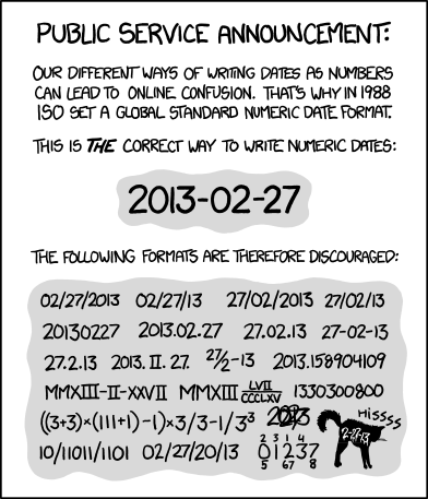
3.3 Follow ISO 8601 for dates

Why?
- Internationally accepted format used across multiple schemas (e.g.
Darwin Core,EML,ISO 19115) - Removes ambiguity related to timezone, daylight savings time changes, and time of day
- Better software integration of time date/time elements
Key Information
- UTC (AKA
ZuluorGMT): Coordinated Universal Time (UTC) is the primary time standard by which the world regulates clocks and time. It is time relative to0°longitude and is not adjusted for daylight saving time. (from Wikipedia). - Conversion to UTC, or between time zones, may depend on daylight savings
Examples: April 3, 2023 standardized to ISO 8601
Description | Written in ISO 8601 |
|---|---|
Date | 2023-04-03 |
Date and Time with timezone offset | 2023-04-03T18:29:38+00:00 |
Date and Time in UTC | 2023-04-03T18:29:38Z |
Time Interval in UTC (April 3 - 5, 2023) | 2023-04-03T18:29:38Z/2023-04-05T00:29:38Z |
Examples: different styles of timezone annotation
Description | Written in ISO 8601 |
|---|---|
Date | 2023-04-03 |
Date and Time with timezone offset | 2023-04-03T18:29:38+00:00 |
Date and Time in UTC | 2023-04-03T18:29:38Z |
Time Interval in UTC (April 3 - 5, 2023) | 2023-04-03T18:29:38Z/2023-04-05T00:29:38Z |
Top References
- ISO 8601 wiki: https://en.wikipedia.org/wiki/ISO_8601
- R package lubridate, OlsonNames()
- Python go-to package, datetime https://docs.python.org/3/library/datetime.html
- Article on datetime uncertainty: https://www.datafix.com.au/BASHing/2020-02-12.html
- Map of offset from UTC: https://www.timeanddate.com/time/map/
- Nice time converter: https://coastwatch.pfeg.noaa.gov/erddap/convert/time.html
3.5 Record latitude and longitude in decimal degrees in WGS84

Why?
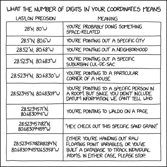
- Users have to know where you collected this data, which requires a latitude, longitude, reference system and uncertainty.
- Decimal-degrees avoids special symbols (
°or‘) which is preferable for machine readable formats WGS84is a reference coordinate system that is widely used and incorporated in many GPS units and tools, and recognized as a standard by many government agencies.
Key Information
- If possible, encourage data providers to confirm, and record, the WGS84 datum prior to data collection.
- Understand and report the device/instrument uncertainty associated with your coordinates because it affects the usability of your data.
- Consider including the vertical component (altitude, depth, height off bottom, elevation, etc)
- Generally speaking,
degrees-minutes-seconds (DMS)can be converted todecimal-degrees (DD)by:DD = d + (min/60) + (sec/3600)- Watch out for mixed formats, like degrees,
decimal-minutes (DDM).
- Degrees West and South become negative in DD.
- Values for longitude range from
-180to180, inclusive. - Values for latitude range from
-90to90, inclusive.
- Values for longitude range from
Example Coordinates
Format | Example |
|---|---|
Decimal Degrees (DD) | 30.50833333 |
Degrees Minutes Seconds (DMS) | 30° 15' 10 N |
Degrees Decimal Minutes (DM or DDM) | 30° 15.1667 N |
Top References
- Existing R/python/ESRI packages/functions
- Getting lat/lon to decimal degrees
https://ioos.github.io/bio_mobilization_workshop/03-data-cleaning/index.html#getting-latlon-to-decimal-degrees - Some background on precision
- DMS to DD calculator
https://www.fcc.gov/media/radio/dms-decimal – The three most commonly used datums are WGS84, NAD83, and NAD27. A more complete list can be found here: https://wiki.gis.com/wiki/index.php/Datum_(geodesy)#List_of_Datums)
3.6 Use persistent unique identifiers
Why?
- It can be useful to have unique identifiers to unambiguously identify granules of information, e.g. dataset, collection, database, taxonomic concept, etc. This will allow users to precisely refer to the data and allow your data to remain identifiable when aggregated with other datasets.
- To be able to uniquely identify a record in your data system or across data systems. Useful to create relational databases or merge records.
- Although it increases workload, it safeguards against confusion and inefficiency in the future.
Key Information
- There are good reasons to keep an identifier opaque, i.e. it does not indicate anything about the content of information it points to. However, there are also transparent, or semi-opaque identifiers in use that take advantage of semantics to guide humans as well as machines.
- One way to create a unique identifier is concatenation of sampling event, location, time, enumeration of unique observation or event. (e.g.
Station_95_Date_09JAN1997:14:35:00.000) - Some prefer using opaque identifiers. (e.g.
10FC9784-B30F-48ED-8DB5-FF65A2A9934E) - If there is an existing persistent unique identifier, it’s usually a good idea to use it (i.e. when using a taxonomic authority like WoRMS and applying their LSID).
- It is important to manage any identifiers you create, if they are not managed by an authority (e.g. DOIs).
- Important that it be persistent (consider samples possibly moving between institutions)
Examples of PIDs
Type of PID | Use Case | Example |
|---|---|---|
Digital Object Identifier (DOI) | Actionable persistent link for papers, data, and other digital objects | https://doi.org/10.6084/m9.figshare.16806712.v2 |
International Geo Sample Number (IGSN) | Persistent identifier for physical samples | http://igsn.org/AU1243> |
Life Science Identifier (LSID) | Persistent structured method for biologically significant data | urn:lsid:marinespecies.org:taxname:218214 |
Open Researcher and Contributor ID (ORCID) | Persistent actionable link for individuals | https://orcid.org/0000-0002-4391-107X |
Top References
- Software and Packages to generate uuids:
- Guidance on how to use GUIDs (Globally Unique Identifiers) to meet specific requirements of the biodiversity information community
http://bioimages.vanderbilt.edu/pages/guid-applicability-final-2011-01.pdf - Use of globally unique identifiers (GUIDs) to link herbarium specimen records to physical specimens
https://bsapubs.onlinelibrary.wiley.com/doi/full/10.1002/aps3.1027 - A Beginner’s Guide to Persistent Identifiers
http://links.gbif.org/persistent_identifiers_guide_en_v1.pdf